2022 Map of Reserve
USGS Topo · Published 2022About this map
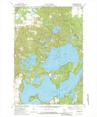
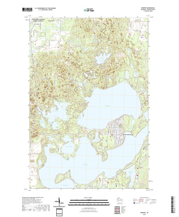
Lac Courte Oreilles and the sprawling Grindstone Lake dominate this Sawyer County landscape, where the shoreline is defined by dense residential clusters and specialized points like Thunder Point and Adams Point. Near the southeastern shores of the larger lakes, the community of Northwoods Beach serves as a hub of local settlement. The map reveals a complex network of waterways, including Windigo Lake and the smaller Little Lac Courte Oreilles, connected by numerous creeks and springs such as Grindstone Creek.
Find a feature on this map
145 named features on this map. Tap any name to fly to it.
Don’t see what you’re looking for? This feature index may not catch every label — zoom into the map to look around manually.
Map Details
Editions of this 2022 Reserve Map
This is the sole edition of this map. No revisions or reprints were ever made.
Historical Maps of Hayward Through Time
6 maps found