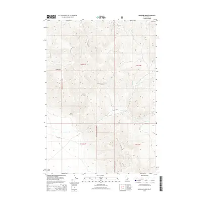
2014 Map of Reservoir Creek
USGS Topo · Published 2014About this map
Salmon National Forest defines the rugged character of this 2014 survey along the Idaho-Montana border, where high-elevation drainage systems create a complex network of canyons and gulches. The landscape is marked by the presence of the Salt Creek Electronic Site positioned among the peaks, reflecting modern utility alongside traditional land uses. Several named water sources including Frank Hall Cr, Quaking Asp Cr, and Reservoir Cr descend from the ridges, while the presence of the Little Bear Creek Spr indicates vital water points in this arid terrain.
Find a feature on this map
28 named features on this map. Tap any name to fly to it.
Don’t see what you’re looking for? This feature index may not catch every label — zoom into the map to look around manually.
Map Details
Editions of this 2014 Reservoir Creek Map
This is the sole edition of this map. No revisions or reprints were ever made.
Other maps of this area

1955 · Dubois
USGS Topo · 1:250,000

1956 · Leadore
USGS Topo · 1:62,500

1956 · Morrison Lake
USGS Topo · 1:62,500

1958 · Dubois
USGS Topo · 1:250,000

1965 · Deadman Pass
USGS Topo · 1:24,000

1965 · Bannock Pass
USGS Topo · 1:24,000
1965 · Medicine Lodge Peak
USGS Topo · 1:24,000

1980 · Leadore
USGS Topo · 1:100,000
1987 · Morrison Lake
USGS Topo · 1:24,000

1987 · Purcell Spring
USGS Topo · 1:24,000