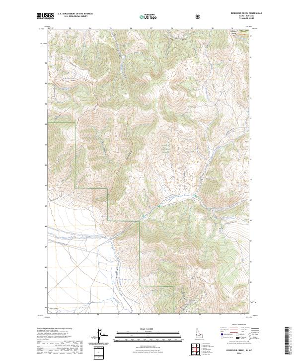
2024 Map of Reservoir Creek
USGS Topo · Published 2024About this map
The Continental Divide forms the high ridgeline boundary of the Salmon National Forest, marking a landscape defined by steep drainages and mountain summits in eastern Lemhi County. This 2024 survey documents a network of Forest Service roads and specialized communication infrastructure, including the Salt Creek Electronic Site and the associated Salt Creek/Repeater Trail. The terrain transitions from the high peaks down into the broad Lemhi Valley, where numerous mountain streams such as Hawley Creek and Reservoir Creek emerge from canyons to join the valley floor. The map illustrates a contemporary working forest managed for both utility and natural preservation, with a distinct system of spur roads like Spr D and Spr E accessing the higher elevations of the Salmon National Forest.
Find a feature on this map
40 named features on this map. Tap any name to fly to it.
Don’t see what you’re looking for? This feature index may not catch every label — zoom into the map to look around manually.
Map Details
Editions of this 2024 Reservoir Creek Map
This is the sole edition of this map. No revisions or reprints were ever made.
Other maps of this area

1955 · Dubois
USGS Topo · 1:250,000

1956 · Leadore
USGS Topo · 1:62,500

1956 · Morrison Lake
USGS Topo · 1:62,500

1958 · Dubois
USGS Topo · 1:250,000

1965 · Deadman Pass
USGS Topo · 1:24,000

1965 · Bannock Pass
USGS Topo · 1:24,000
1965 · Medicine Lodge Peak
USGS Topo · 1:24,000

1980 · Leadore
USGS Topo · 1:100,000
1987 · Morrison Lake
USGS Topo · 1:24,000

1987 · Purcell Spring
USGS Topo · 1:24,000