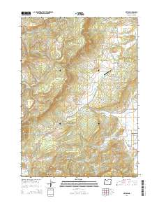
2014 Map of Reston
USGS Topo · Published 2014About this map
Flournoy Valley and Lookingglass Valley anchor the eastern half of this terrain, where agricultural and residential development concentrate along the drainage basins of Flournoy Cr and Morgan Cr. The 2014 survey documents a landscape where modern infrastructure, including the Flournoy Valley Airport and Lookingglass Airport, sits alongside the historic route of the Coos Bay Wagon Rd. The settlement of Reston is positioned near the southern border, surrounded by complex topography marked by Sibold Canyon and the prominent Reston Ridge.
Find a feature on this map
73 named features on this map. Tap any name to fly to it.
Don’t see what you’re looking for? This feature index may not catch every label — zoom into the map to look around manually.
Map Details
Editions of this 2014 Reston Map
This is the sole edition of this map. No revisions or reprints were ever made.
Other maps of this area

1897 · Roseburg
USGS Topo · 1:125,000

1900 · Roseburg
USGS Topo · 1:125,000

1928 · Sitkum
USGS Topo · 1:125,000

1954 · Sutherlin
USGS Topo · 1:62,500

1955 · Camas Valley
USGS Topo · 1:62,500

1955 · Tyee
USGS Topo · 1:62,500

1955 · Roseburg
USGS Topo · 1:62,500

1958 · Roseburg
USGS Topo · 1:250,000

1959 · Roseburg
USGS Topo · 1:250,000

1979 · Roseburg
USGS Topo · 1:100,000