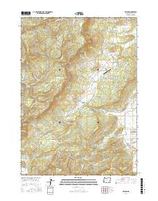
2017 Map of Reston
USGS Topo · Published 2017About this map
Lookingglass Valley and Flournoy Valley dominate this landscape west of Roseburg, where the rural character of Douglas County is defined by a mix of creek-fed basins and timbered ridges. The historic Coos Bay Wagon Rd traverses the central valley, a reminder of the region's early transportation networks connecting the interior to the coast. Small settlements like Lookingglass and Reston serve as anchors for the surrounding agricultural and timber lands, with local aviation hubs such as the Flournoy Valley Airport and Lookingglass Airport providing utility for the area's residents.
Find a feature on this map
70 named features on this map. Tap any name to fly to it.
Don’t see what you’re looking for? This feature index may not catch every label — zoom into the map to look around manually.
Map Details
Editions of this 2017 Reston Map
This is the sole edition of this map. No revisions or reprints were ever made.
Other maps of this area

1897 · Roseburg
USGS Topo · 1:125,000

1900 · Roseburg
USGS Topo · 1:125,000

1928 · Sitkum
USGS Topo · 1:125,000

1954 · Sutherlin
USGS Topo · 1:62,500

1955 · Camas Valley
USGS Topo · 1:62,500

1955 · Tyee
USGS Topo · 1:62,500

1955 · Roseburg
USGS Topo · 1:62,500

1958 · Roseburg
USGS Topo · 1:250,000

1959 · Roseburg
USGS Topo · 1:250,000

1979 · Roseburg
USGS Topo · 1:100,000