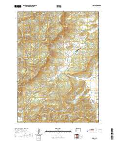
2020 Map of Reston
USGS Topo · Published 2020About this map
Lookingglass Valley and Flournoy Valley characterize the eastern portion of this Douglas County region, where private aviation and agricultural commerce define the landscape. The historically significant Coos Bay Wagon Rd traverses the terrain, a reminder of the vital transportation links that once connected the interior valleys to the Oregon coast. Water resources are managed through several catchments, including the Doerner Cr Reservoir, Wylie Reservoir, and Smith Reservoir, which support the surrounding rural settlements. To the west, the land rises sharply toward the heights of Sugar Pine Ridge and Eagle Rock, cut by deep drainages like Sibold Canyon. This contemporary topographic record details the complex network of timber and access roads, such as Callahan Rd and Flournoy Valley Rd, that weave through the ridgelines and creek bottoms.
Find a feature on this map
77 named features on this map. Tap any name to fly to it.
Don’t see what you’re looking for? This feature index may not catch every label — zoom into the map to look around manually.
Map Details
Editions of this 2020 Reston Map
This is the sole edition of this map. No revisions or reprints were ever made.
Other maps of this area

1897 · Roseburg
USGS Topo · 1:125,000

1900 · Roseburg
USGS Topo · 1:125,000

1928 · Sitkum
USGS Topo · 1:125,000

1954 · Sutherlin
USGS Topo · 1:62,500

1955 · Camas Valley
USGS Topo · 1:62,500

1955 · Tyee
USGS Topo · 1:62,500

1955 · Roseburg
USGS Topo · 1:62,500

1958 · Roseburg
USGS Topo · 1:250,000

1959 · Roseburg
USGS Topo · 1:250,000

1979 · Roseburg
USGS Topo · 1:100,000