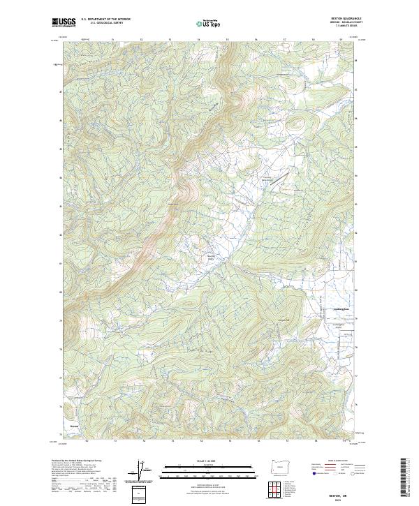
2023 Map of Reston
USGS Topo · Published 2023About this map
The Flournoy Valley and the valley of Lookingglass Creek dominate the landscape in this Douglas County survey, revealing a rural network of family-held lands and aviation history. Small private airstrips like the Flournoy Valley Airport and Lookingglass Airport suggest the importance of local flight in this pocket of the Oregon Coast Range. Historical transit routes are evident in the path of the Coos Bay Wagon Rd, a significant pioneer-era thoroughfare that once linked the inland valleys to the coast.
Find a feature on this map
76 named features on this map. Tap any name to fly to it.
Don’t see what you’re looking for? This feature index may not catch every label — zoom into the map to look around manually.
Map Details
Editions of this 2023 Reston Map
This is the sole edition of this map. No revisions or reprints were ever made.
Other maps of this area

1897 · Roseburg
USGS Topo · 1:125,000

1900 · Roseburg
USGS Topo · 1:125,000

1928 · Sitkum
USGS Topo · 1:125,000

1954 · Sutherlin
USGS Topo · 1:62,500

1955 · Camas Valley
USGS Topo · 1:62,500

1955 · Tyee
USGS Topo · 1:62,500

1955 · Roseburg
USGS Topo · 1:62,500

1958 · Roseburg
USGS Topo · 1:250,000

1959 · Roseburg
USGS Topo · 1:250,000

1979 · Roseburg
USGS Topo · 1:100,000