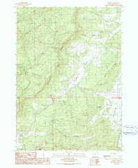
1990 Map of Reston
USGS Topo · Published 1990About this map
The small settlement of Reston anchors this corner of Douglas County as it appeared in the late 1980s, serving as a focal point for the surrounding timber and ranching landscape. The topography is defined by prominent elevations such as Reston Ridge and Sugar Pine Ridge, which hem in the productive lowlands of Flournoy Valley and Lookingglass Valley. Evidence of local industry is visible through the presence of a Quarry and a Substation, while the drainage system is dominated by Lookingglass Creek and its many tributaries, including Morgan Creek and Porter Creek. Notable landmarks like Eagle Rock and Bushnell Rock provide distinct navigational markers across the rugged terrain, which is also crisscrossed by the Williams River and Little Cow Creek. This 1990 provisional edition captures the rural character of the region before significant modern development altered these traditional land-use patterns.
Find a feature on this map
28 named features on this map. Tap any name to fly to it.
Don’t see what you’re looking for? This feature index may not catch every label — zoom into the map to look around manually.
Map Details
Editions of this 1990 Reston Map
This is the sole edition of this map. No revisions or reprints were ever made.
Other maps of this area

1897 · Roseburg
USGS Topo · 1:125,000

1900 · Roseburg
USGS Topo · 1:125,000

1928 · Sitkum
USGS Topo · 1:125,000

1954 · Sutherlin
USGS Topo · 1:62,500

1955 · Camas Valley
USGS Topo · 1:62,500

1955 · Tyee
USGS Topo · 1:62,500

1955 · Roseburg
USGS Topo · 1:62,500

1958 · Roseburg
USGS Topo · 1:250,000

1959 · Roseburg
USGS Topo · 1:250,000

1979 · Roseburg
USGS Topo · 1:100,000