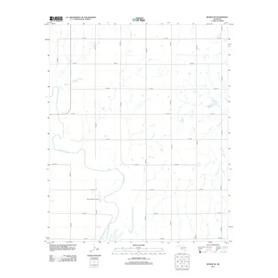
2012 Map of Retrop SE
USGS Topo · Published 2012About this map
The N Fork Red River meanders across this rural section of Oklahoma, its wide sandy bed and braided channels defining the southwestern landscape. The terrain is structured by a rigorous section-line grid of rural roads, including E1310 Rd and N2040 Rd, which reflect the enduring legacy of the Public Land Survey System in organizing the state's agricultural interior. A notable landmark in this sparsely populated area is the Twin Lakes Ranch Airport, a private aviation facility situated near a prominent bend in the river. This 2012 survey captures the area's modern infrastructure while showcasing the natural hydrology of the Red River system, illustrating how transport routes like E1350 Rd adapt to the winding riverbanks and local drainage patterns.
Find a feature on this map
19 named features on this map. Tap any name to fly to it.
Don’t see what you’re looking for? This feature index may not catch every label — zoom into the map to look around manually.
Map Details
Editions of this 2012 Retrop SE Map
This is the sole edition of this map. No revisions or reprints were ever made.
Other maps of this area

1955 · Lawton
USGS Topo · 1:250,000

1955 · Clinton
USGS Topo · 1:250,000

1957 · Clinton
USGS Topo · 1:250,000

1961 · Hobart
USGS Topo · 1:62,500

1961 · Retrop
USGS Topo · 1:62,500

1964 · Lone Wolf
USGS Topo · 1:24,000

1971 · Granite
USGS Topo · 1:24,000

1971 · Lake Altus
USGS Topo · 1:24,000

1984 · Sentinel
USGS Topo · 1:24,000
1984 · Cambridge
USGS Topo · 1:24,000