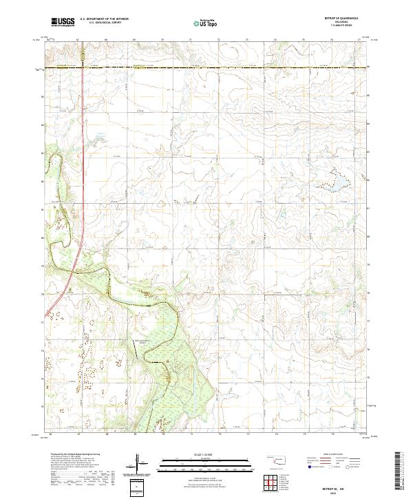
2022 Map of Retrop SE
USGS Topo · Published 2022About this map
The North Fork Red River meanders across the southwestern corner of this Oklahoma landscape, defining the boundary between Greer Co and Kiowa Co. This area is characterized by a high-density grid of section roads, illustrating the enduring influence of the Public Land Survey System on local transportation and property lines. Near the river’s edge, the Twin Lakes Ranch and its associated Twin Lakes Ranch Airport stand out as focal points in an otherwise sparsely populated rural terrain. To the north, the jurisdictional intersection of Beckham Co, Washita Co, and Kiowa Co is marked by the long stretch of Co Line Rd. Water management is evident through features like 075001 Reservoir 7, while the route of Old State Hwy 6 hints at the evolution of regional thoroughfares through the Oklahoma plains.
Find a feature on this map
39 named features on this map. Tap any name to fly to it.
Don’t see what you’re looking for? This feature index may not catch every label — zoom into the map to look around manually.
Map Details
Editions of this 2022 Retrop SE Map
This is the sole edition of this map. No revisions or reprints were ever made.
Other maps of this area

1955 · Lawton
USGS Topo · 1:250,000

1955 · Clinton
USGS Topo · 1:250,000

1957 · Clinton
USGS Topo · 1:250,000

1961 · Hobart
USGS Topo · 1:62,500

1961 · Retrop
USGS Topo · 1:62,500

1964 · Lone Wolf
USGS Topo · 1:24,000

1971 · Granite
USGS Topo · 1:24,000

1971 · Lake Altus
USGS Topo · 1:24,000

1984 · Sentinel
USGS Topo · 1:24,000
1984 · Cambridge
USGS Topo · 1:24,000