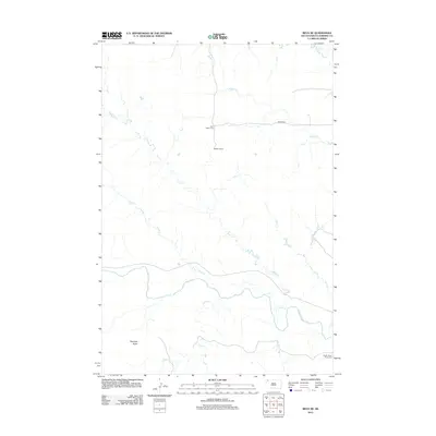
2012 Map of Reva NE
USGS Topo · Published 2012About this map
Saint Isidore Cem stands as a focal point for genealogy in this prairie landscape of Harding County, marking a quiet record of early settlers north of the S Fork Grand River. The terrain is defined by its extensive drainage network, where Skull Cr, Brush Cr, and Middle Cr converge toward the river valley. To the south, the prominent elevation of Haystack Butte anchors the horizon above Fisher Cr. Human presence is mapped through ranching and transit, notably at the Wagner Ranch and along Wagner Rd. Near the riverbanks, the South Grand River Cem provides further historical context for the dispersed communities that have long inhabited this corner of South Dakota.
Find a feature on this map
13 named features on this map. Tap any name to fly to it.
Don’t see what you’re looking for? This feature index may not catch every label — zoom into the map to look around manually.
Map Details
Editions of this 2012 Reva NE Map
This is the sole edition of this map. No revisions or reprints were ever made.
Other maps of this area

1935 · Reva
USGS Topo · 1:125,000

1954 · Lemmon
USGS Topo · 1:250,000

1957 · Lemmon
USGS Topo · 1:250,000

1968 · Reva
USGS Topo · 1:24,000

1968 · Ralph SW
USGS Topo · 1:24,000

1968 · Ralph
USGS Topo · 1:24,000

1969 · Battleship Rock
USGS Topo · 1:24,000

1969 · Reva NW
USGS Topo · 1:24,000

1969 · Reva NE
USGS Topo · 1:24,000

1980 · Camp Crook
USGS Topo · 1:100,000