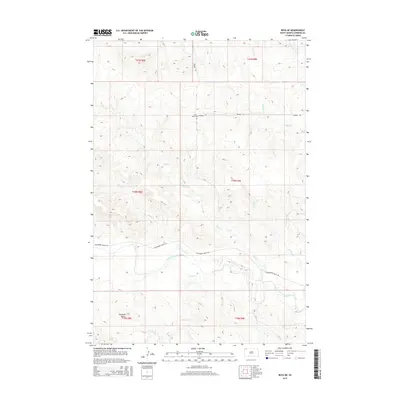
2015 Map of Reva NE
USGS Topo · Published 2015About this map
The South Fork Grand River meanders across this rural section of Harding County, providing the primary drainage for a network of intermittent creeks including Skull Cr and Fisher Cr. The landscape is dominated by the prominent elevation of Haystack Butte, a significant navigational landmark in this corner of the state. Settlement traces are sparse, concentrated around the Saint Isidore Cem and a handful of ranch roads that follow the section lines of the Public Land Survey System. The map documents a classic Great Plains grazing environment where transport is limited to corridors like Wagner Rd and Hackamore Ranch Rd, connecting isolated homesteads across the drainage basins of Middle Cr and Olson Cr.
Find a feature on this map
18 named features on this map. Tap any name to fly to it.
Don’t see what you’re looking for? This feature index may not catch every label — zoom into the map to look around manually.
Map Details
Editions of this 2015 Reva NE Map
This is the sole edition of this map. No revisions or reprints were ever made.
Other maps of this area

1935 · Reva
USGS Topo · 1:125,000

1954 · Lemmon
USGS Topo · 1:250,000

1957 · Lemmon
USGS Topo · 1:250,000

1968 · Reva
USGS Topo · 1:24,000

1968 · Ralph SW
USGS Topo · 1:24,000

1968 · Ralph
USGS Topo · 1:24,000

1969 · Battleship Rock
USGS Topo · 1:24,000

1969 · Reva NW
USGS Topo · 1:24,000

1969 · Reva NE
USGS Topo · 1:24,000

1980 · Camp Crook
USGS Topo · 1:100,000