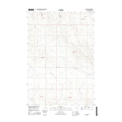
2015 Map of Reva NW
USGS Topo · Published 2015About this map
Big Two Top Butte and Little Two Top Butte dominate the northern horizon of this landscape in Harding County. The terrain is defined by a dense network of intermittent drainage channels, where Horse Cr and Turtle Cr wind through the open country. These waterways, including Skull Cr and Brush Cr to the east, dictate the movement across the land, with local infrastructure following the natural contours. Transportation in this corner of South Dakota is sparse, anchored by Glen Levite Rd and Hackamore Ranch Rd, which provide access to ranching properties and remote allotments. The map reveals a high-plains environment where water sources like Prairie Dog Cr and Eggland Cr are central to the geography, reflecting the essential relationship between the seasonal creeks and the livestock operations of the region.
Find a feature on this map
20 named features on this map. Tap any name to fly to it.
Don’t see what you’re looking for? This feature index may not catch every label — zoom into the map to look around manually.
Map Details
Editions of this 2015 Reva NW Map
This is the sole edition of this map. No revisions or reprints were ever made.
Other maps of this area

1935 · Reva
USGS Topo · 1:125,000

1954 · Lemmon
USGS Topo · 1:250,000

1957 · Lemmon
USGS Topo · 1:250,000

1968 · Reva
USGS Topo · 1:24,000

1968 · Ralph SW
USGS Topo · 1:24,000

1968 · Ludlow SE
USGS Topo · 1:24,000

1968 · Ralph
USGS Topo · 1:24,000

1969 · Battleship Rock
USGS Topo · 1:24,000

1969 · Reva NW
USGS Topo · 1:24,000

1969 · Reva NE
USGS Topo · 1:24,000