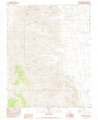
1982 Map of Revenue Canyon
USGS Topo · Published 1983About this map
Mining operations and historical sites dominate this landscape along the eastern slopes of the Argus Range. Based on data field-checked in the late 1970s, the map identifies numerous active and former extraction sites, including the Defense Mine, Modoc Mine, and Argus Sterling Mine. For those tracing historical habitations, the Lookout City (Site) is noted atop Lookout Mountain, indicating the footprint of a once-active settlement overlooking the vast Panamint Valley.
Find a feature on this map
25 named features on this map. Tap any name to fly to it.
Don’t see what you’re looking for? This feature index may not catch every label — zoom into the map to look around manually.
Map Details
Editions of this 1982 Revenue Canyon Map
2 editions found
Other maps of this area

1908 · Ballarat
USGS Topo · 1:250,000

1913 · Ballarat
USGS Topo · 1:250,000

1948 · Death Valley
USGS Topo · 1:250,000

1950 · Darwin
USGS Topo · 1:62,500

1951 · Darwin
USGS Topo · 1:62,500

1951 · Panamint Butte
USGS Topo · 1:62,500

1951 · Maturango Peak
USGS Topo · 1:62,500

1951 · Coso Peak
USGS Topo · 1:62,500

1954 · Death Valley
USGS Topo · 1:250,000

1956 · Death Valley
USGS Topo · 1:250,000