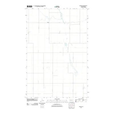
2011 Map of Revere
USGS Topo · Published 2011About this map
The small settlement of Revere sits on the high plains of Griggs County, serving as a quiet focal point in a landscape defined by organized section lines and a significant riparian corridor. The most prominent natural feature is Baldhill Creek, which meanders through the northern portion of the quadrangle, creating a distinct contrast to the rigid grid of rural roads like County Rd 9 and 4th St Se. This 2011 survey reveals a classic North Dakota agricultural layout, where isolated farmsteads are connected by a network of numbered avenues, such as 104th Ave Se and 107th Ave Se. The map also captures numerous prairie potholes and small water bodies scattered across the terrain, illustrating the glacial heritage of the region.
Find a feature on this map
17 named features on this map. Tap any name to fly to it.
Don’t see what you’re looking for? This feature index may not catch every label — zoom into the map to look around manually.
Map Details
Editions of this 2011 Revere Map
This is the sole edition of this map. No revisions or reprints were ever made.
Other maps of this area

1952 · New Rockford
USGS Topo · 1:250,000

1956 · New Rockford
USGS Topo · 1:250,000

1961 · Sutton
USGS Topo · 1:24,000

1961 · Revere
USGS Topo · 1:24,000

1961 · Wimbledon
USGS Topo · 1:24,000

1961 · Hannaford
USGS Topo · 1:24,000

1961 · Wimbledon NE
USGS Topo · 1:24,000

1961 · Cooperstown West
USGS Topo · 1:24,000

1961 · Sutton NE
USGS Topo · 1:24,000
1961 · Sutton SW
USGS Topo · 1:24,000