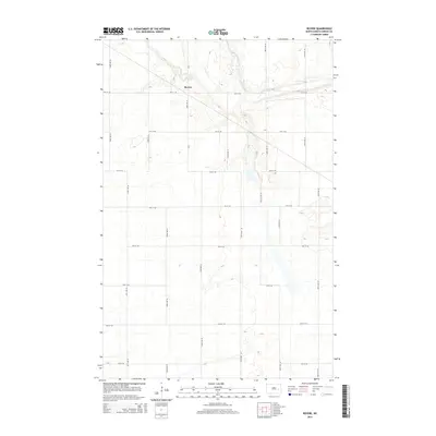
2014 Map of Revere
USGS Topo · Published 2014About this map
Revere serves as the central focal point of this North Dakota landscape, situated at the junction of Cr-9 and 4th St SE. The terrain is defined by the meandering course of Baldhill Creek, which cuts through the northeastern portion of the quadrangle. This 2014 survey illustrates a rigid sectional grid of rural roads, including 5th St SE and 104th Ave SE, that carve the prairie into precise agricultural blocks. The map reveals a sparsely populated region where development is concentrated near the creek valley and along established county routes, reflecting the enduring rural character of Griggs County in the early 21st century.
Find a feature on this map
19 named features on this map. Tap any name to fly to it.
Don’t see what you’re looking for? This feature index may not catch every label — zoom into the map to look around manually.
Map Details
Editions of this 2014 Revere Map
This is the sole edition of this map. No revisions or reprints were ever made.
Other maps of this area

1952 · New Rockford
USGS Topo · 1:250,000

1956 · New Rockford
USGS Topo · 1:250,000

1961 · Sutton
USGS Topo · 1:24,000

1961 · Revere
USGS Topo · 1:24,000

1961 · Wimbledon
USGS Topo · 1:24,000

1961 · Hannaford
USGS Topo · 1:24,000

1961 · Wimbledon NE
USGS Topo · 1:24,000

1961 · Cooperstown West
USGS Topo · 1:24,000

1961 · Sutton NE
USGS Topo · 1:24,000
1961 · Sutton SW
USGS Topo · 1:24,000