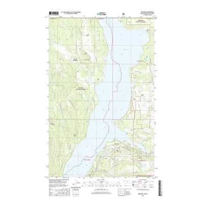
2017 Map of Rexford
USGS Topo · Published 2017About this map
Lake Koocanusa dominates the central corridor of this Lincoln County survey, illustrating the modern geography of the Kootenai River valley north of the Libby Dam. To the east, the Tobacco Plains provide a relatively level contrast to the rising Purcell Mountains on the western flank. The settlement of Rexford sits along the eastern shore, serving as a gateway to the extensive Kootenai National Forest lands that surround the basin. Hikers and researchers can trace the path of the Pacific NW National Scenic Trail as it winds through the southern portion of the quadrangle. The map also documents numerous smaller water bodies, such as Alkali Lake and Sophie Lake, alongside family-named landmarks like Olsen Hill and Hunter Point, reflecting the region's long-standing connection to timber and outdoor recreation.
Find a feature on this map
64 named features on this map. Tap any name to fly to it.
Don’t see what you’re looking for? This feature index may not catch every label — zoom into the map to look around manually.
Map Details
Editions of this 2017 Rexford Map
This is the sole edition of this map. No revisions or reprints were ever made.
Other maps of this area

1957 · Kalispell
USGS Topo · 1:250,000

1960 · Kalispell
USGS Topo · 1:250,000

1961 · Kalispell
USGS Topo · 1:250,000

1963 · Rexford
USGS Topo · 1:24,000

1963 · Eureka North
USGS Topo · 1:24,000

1963 · Eureka South
USGS Topo · 1:24,000

1963 · Red Mountain
USGS Topo · 1:24,000

1963 · Webb Mountain
USGS Topo · 1:24,000
1963 · Beartrap Mountain
USGS Topo · 1:24,000

1979 · Yaak River
USGS Topo · 1:100,000