
1963 Map of Red Mountain
USGS Topo · Published 1966About this map
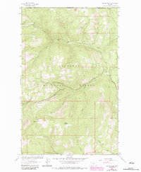
Kootenai National Forest dominates this high-altitude landscape along the international border during the early 1960s. The terrain is defined by the drainage systems of the East Fork Yaak River and Young Creek, with the latter branching into distinct north, south, and middle forks. These waterways carve through a series of prominent peaks, including Red Mountain and Clingback Mountain, reflecting the remote and undeveloped character of the Montana and British Columbia boundary region.
Find a feature on this map
19 named features on this map. Tap any name to fly to it.
Don’t see what you’re looking for? This feature index may not catch every label — zoom into the map to look around manually.
Map Details
Editions of this 1963 Red Mountain Map
2 editions found
Other maps of this area

1957 · Kalispell
USGS Topo · 1:250,000

1960 · Kalispell
USGS Topo · 1:250,000

1961 · Kalispell
USGS Topo · 1:250,000

1963 · Rexford
USGS Topo · 1:24,000

1963 · Robinson Mountain
USGS Topo · 1:24,000

1963 · Webb Mountain
USGS Topo · 1:24,000

1963 · Boulder Lakes
USGS Topo · 1:24,000
1963 · Beartrap Mountain
USGS Topo · 1:24,000

1979 · Yaak River
USGS Topo · 1:100,000
1983 · Rexford
USGS Topo · 1:24,000