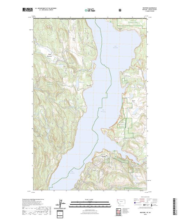
2024 Map of Rexford
USGS Topo · Published 2024About this map
West Kootenai and Rexford anchor the western and eastern shores of Lake Koocanusa in this contemporary overview of the Montana borderlands. The vast reservoir, created by the damming of the Kootenai River, dominates the central valley, flanked by the Purcell Mountains to the west and the Tobacco Plains to the east. The landscape is a study in forest management and land use within the Kootenai National Forest, defined by an extensive network of forestry roads such as Natl Forest Develop Road 7212 Rd and Natl Forest Develop Road 92 Rd. The Tobacco River feeds into the lake near the modern townsite of Rexford, while the Pacific Northwest National Scenic Trl traverses the southern ridges. Small glacial features like Swisher Lake, Tooley Lake, and Grob Lake dot the plateau, marking the complex topography of the Kootenai Flats.
Find a feature on this map
77 named features on this map. Tap any name to fly to it.
Don’t see what you’re looking for? This feature index may not catch every label — zoom into the map to look around manually.
Map Details
Editions of this 2024 Rexford Map
This is the sole edition of this map. No revisions or reprints were ever made.
Other maps of this area

1957 · Kalispell
USGS Topo · 1:250,000

1960 · Kalispell
USGS Topo · 1:250,000

1961 · Kalispell
USGS Topo · 1:250,000

1963 · Rexford
USGS Topo · 1:24,000

1963 · Eureka North
USGS Topo · 1:24,000

1963 · Eureka South
USGS Topo · 1:24,000

1963 · Red Mountain
USGS Topo · 1:24,000

1963 · Webb Mountain
USGS Topo · 1:24,000
1963 · Beartrap Mountain
USGS Topo · 1:24,000

1979 · Yaak River
USGS Topo · 1:100,000