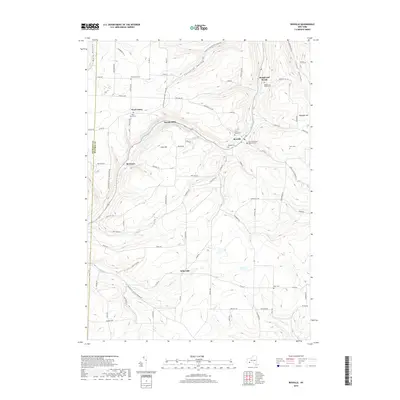
2019 Map of Rexville
USGS Topo · Published 2019About this map
Rexville and the surrounding rural landscape of the Southern Tier are defined by a network of steep-sided valleys and creek-side settlements. This survey documents the intersection of local history and topography, from the drainage of Marsh Creek and Bennetts Cr to the heights of Irish Hill and Wheeler Hill. Genealogists will find a concentration of burial sites, including Saint Marys New Catholic Cem and the Hauber Cem, which speak to the area's long-established communities. The layout of rural routes such as Christian Hollow West Union Rd and Whitesville Whites Corners Rd connects smaller hamlets like West Union and Rough and Ready with larger geographical features like the Italian Valley and the N Fork Cowanesque River at the southern edge of the sheet.
Find a feature on this map
84 named features on this map. Tap any name to fly to it.
Don’t see what you’re looking for? This feature index may not catch every label — zoom into the map to look around manually.
Map Details
Editions of this 2019 Rexville Map
This is the sole edition of this map. No revisions or reprints were ever made.
Other maps of this area

1899 · Gaines
USGS Topo · 1:62,500

1900 · Gaines
USGS Topo · 1:62,500

1926 · Wellsville
USGS Topo · 1:62,500

1926 · Greenwood
USGS Topo · 1:62,500

1932 · Genesee
USGS Topo · 1:62,500

1937 · Genesee
USGS Topo · 1:62,500

1950 · Elmira
USGS Topo · 1:250,000

1954 · Williamsport
USGS Topo · 1:250,000

1954 · South Canisteo
USGS Topo · 1:24,000

1954 · Troupsburg
USGS Topo · 1:24,000