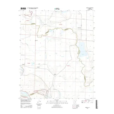
2014 Map of Reydell
USGS Topo · Published 2014About this map
Reydell and the surrounding agricultural lowlands of the Arkansas delta are defined by the complex, winding course of Bayou Meto as it snakes across the Jefferson and Arkansas county lines. This 2014 survey reveals a landscape heavily shaped by drainage and irrigation, with features like Big Grassy Brake, Cross Bayou, and Bear Bayou intersecting the grid of rural roads. The area retains several small community centers and landmarks important for local history, including the settlement of Langford and its nearby Langford Cem, as well as the landing area of Birmac at the western edge. To the south, the Arkansas River cuts through the corner of the map, while the northern reaches transition into the broad, low terrain of Buckingham Flat. Reservoirs and managed waters such as Rodgers Reservoir, Lemmons Lake, and English Lake indicate the ongoing importance of water management in this river-border region.
Find a feature on this map
43 named features on this map. Tap any name to fly to it.
Don’t see what you’re looking for? This feature index may not catch every label — zoom into the map to look around manually.
Map Details
Editions of this 2014 Reydell Map
This is the sole edition of this map. No revisions or reprints were ever made.
Other maps of this area

1935 · Varner
USGS Topo · 1:62,500

1935 · Gillett
USGS Topo · 1:62,500

1941 · De Witt
USGS Topo · 1:62,500

1941 · Goldman
USGS Topo · 1:62,500

1948 · Helena
USGS Topo · 1:250,000

1950 · Helena
USGS Topo · 1:250,000

1954 · De Witt
USGS Topo · 1:62,500

1955 · Helena
USGS Topo · 1:250,000

1959 · Helena
USGS Topo · 1:250,000

1960 · Helena
USGS Topo · 1:250,000