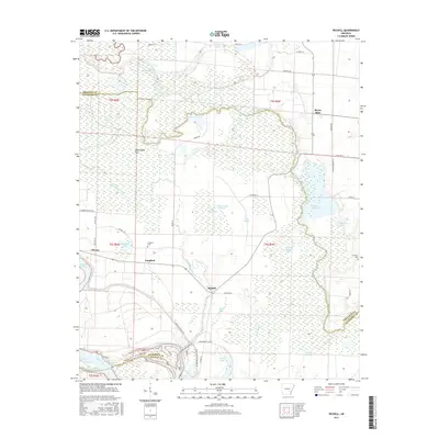
2017 Map of Reydell
USGS Topo · Published 2017About this map
Bayou Meto winds through this Arkansas delta landscape, defining the boundaries and topography of a region dominated by wetlands and agriculture. The settlement of Reydell sits at a central crossroads, surrounded by specialized aquatic features like Reydell Brake and Big Grassy Brake, which characterize the bottomland environment. To the west, the community of Langford is situated near Langford Lake and the Langford Cem, offering specific points of interest for genealogists tracing local families. The southern edge of the map is defined by the Arkansas River, where the Little Bayou Meto Cutoff and Bayou Meto Park Rd indicate a landscape managed for both drainage and recreation. The presence of Rodgers Reservoir and several named lakes like Lemmons Lake highlights the importance of water management in this fertile corridor near the intersection of Arkansas, Jefferson, and Lincoln counties.
Find a feature on this map
55 named features on this map. Tap any name to fly to it.
Don’t see what you’re looking for? This feature index may not catch every label — zoom into the map to look around manually.
Map Details
Editions of this 2017 Reydell Map
This is the sole edition of this map. No revisions or reprints were ever made.
Other maps of this area

1935 · Varner
USGS Topo · 1:62,500

1935 · Gillett
USGS Topo · 1:62,500

1941 · De Witt
USGS Topo · 1:62,500

1941 · Goldman
USGS Topo · 1:62,500

1948 · Helena
USGS Topo · 1:250,000

1950 · Helena
USGS Topo · 1:250,000

1954 · De Witt
USGS Topo · 1:62,500

1955 · Helena
USGS Topo · 1:250,000

1959 · Helena
USGS Topo · 1:250,000

1960 · Helena
USGS Topo · 1:250,000