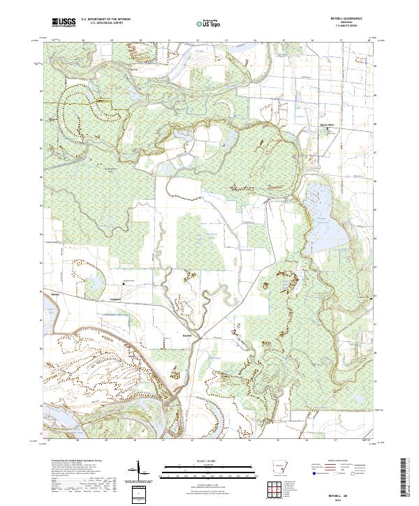
2024 Map of Reydell
USGS Topo · Published 2024About this map
Reydell serves as a central hub in this riverine landscape of Jefferson County, where the low-lying terrain is defined by the complex hydrology of Bayou Meto and the Arkansas River. This modern survey details a region dominated by wetlands and specialized water features, including cypress brakes such as Hagler Cypress Brake and Big Grassy Brake. The settlement patterns follow the higher ground near these watercourses, with the small community of Langford and its associated Langford Cem situated west of the main bayou. The map illustrates a landscape of agricultural utility and drainage management, evidenced by features like the Little Bayou Meto Cutoff and numerous named lakes like English Lake and Goose Lake. Local history is preserved through several rural burial grounds, including Lemmons Cem and the Bayou Meto Cem, which anchor the small hamlets and family-named landmarks such as Buckingham Flat.
Find a feature on this map
51 named features on this map. Tap any name to fly to it.
Don’t see what you’re looking for? This feature index may not catch every label — zoom into the map to look around manually.
Map Details
Editions of this 2024 Reydell Map
This is the sole edition of this map. No revisions or reprints were ever made.
Other maps of this area

1935 · Varner
USGS Topo · 1:62,500

1935 · Gillett
USGS Topo · 1:62,500

1941 · De Witt
USGS Topo · 1:62,500

1941 · Goldman
USGS Topo · 1:62,500

1948 · Helena
USGS Topo · 1:250,000

1950 · Helena
USGS Topo · 1:250,000

1954 · De Witt
USGS Topo · 1:62,500

1955 · Helena
USGS Topo · 1:250,000

1959 · Helena
USGS Topo · 1:250,000

1960 · Helena
USGS Topo · 1:250,000