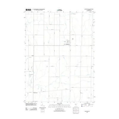
2012 Map of Reynolds
USGS Topo · Published 2012About this map
Reynolds serves as the primary hub of this rural landscape, situated at the intersection of several local routes such as Lloyd St and Williams St. The surrounding countryside is defined by its agricultural layout, punctuated by small settlements and family burial grounds that anchor the local history. Genealogists will find interest in the distribution of several cemeteries, including Reynolds Cem, Hamlet Cem, and the more remote Gray Cem and Corns Cem. To the south, Gingle Corners sits near the Mercer County Airport, illustrating the sparse but organized settlement pattern of the region.
Find a feature on this map
56 named features on this map. Tap any name to fly to it.
Don’t see what you’re looking for? This feature index may not catch every label — zoom into the map to look around manually.
Map Details
Editions of this 2012 Reynolds Map
This is the sole edition of this map. No revisions or reprints were ever made.
Other maps of this area

1912 · Milan
USGS Topo · 1:62,500

1916 · Edgington
USGS Topo · 1:62,500

1923 · Alexis
USGS Topo · 1:62,500

1925 · Alexis
USGS Topo · 1:62,500

1935 · Keithsburg
USGS Topo · 1:48,000

1938 · Edgington
USGS Topo · 1:62,500

1941 · Keithsburg
USGS Topo · 1:62,500

1944 · Milan
USGS Topo · 1:62,500
1948 · Milan
USGS Topo · 1:24,000

1950 · Milan
USGS Topo · 1:24,000