2023 Map of Reynoldsville
USGS Topo · Published 2023About this map
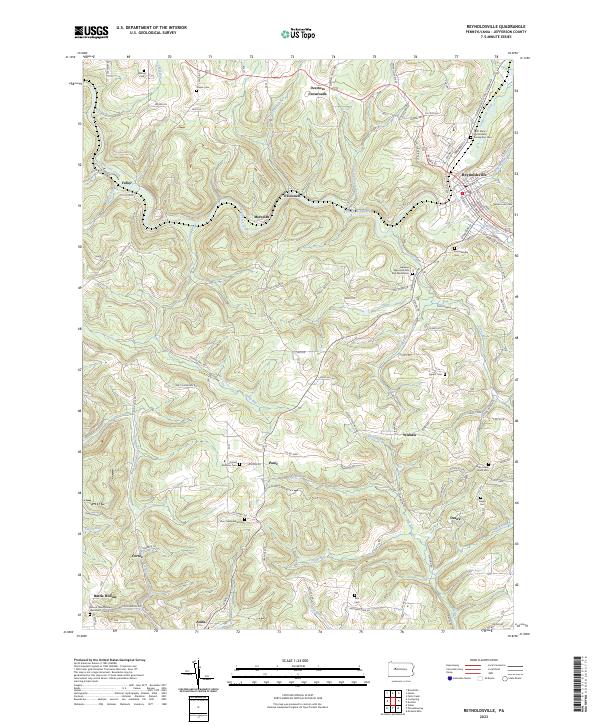
Reynoldsville serves as the primary population center in this part of Jefferson County, where the street grid is confined by the winding course of Sandy Lick Creek and its various tributaries like Pitchpine Run and Soldier Run. The map reveals a landscape defined by small upland settlements and descriptive place names that suggest a rural, tightly-knit history, including Panic, Desire, and Wishaw. These hamlets are connected by a network of ridge-running roads like Old Turnpike Rd and Himes Hill Rd, reflecting a settlement pattern dictated by the undulating topography of the Allegheny Plateau.
Find a feature on this map
111 named features on this map. Tap any name to fly to it.
Don’t see what you’re looking for? This feature index may not catch every label — zoom into the map to look around manually.
Map Details
Editions of this 2023 Reynoldsville Map
This is the sole edition of this map. No revisions or reprints were ever made.
Historical Maps of Reynoldsville Through Time
Featured Locations
- Reynoldsville, PA
- Henderson Township, PA
- McCalmont Township, PA
- Murray Summit, Winslow Township
- O'Donnell, Winslow Township