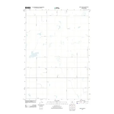
2012 Map of Rezac Lake
USGS Topo · Published 2012About this map
Bohemian Cem stands as a significant cultural marker in this rural Hand County landscape, situated near the intersection of 179th St and 342nd Ave. The terrain is defined by a series of wetlands and drainage patterns typical of the glaciated plains, with Rezac Lake serving as a prominent local water feature. The hydrologic network includes Baloun Cr to the west and Lost Cr winding through the central and southern portions of the quadrangle. This 2012 survey illustrates a classic sectional grid system, where long stretches of gravel roads like 174th St and 347th Ave delineate vast agricultural tracts. The scarcity of named settlements highlights the area's specialized land use, making the few cultural landmarks like the cemetery critical for genealogists and local historians tracing heritage in this part of South Dakota.
Find a feature on this map
17 named features on this map. Tap any name to fly to it.
Don’t see what you’re looking for? This feature index may not catch every label — zoom into the map to look around manually.
Map Details
Editions of this 2012 Rezac Lake Map
This is the sole edition of this map. No revisions or reprints were ever made.
Other maps of this area

1949 · Ree Heights NW
USGS Topo · 1:24,000

1949 · Mitchell Lake
USGS Topo · 1:24,000

1950 · Highmore NE
USGS Topo · 1:24,000

1950 · Mitchell Lake
USGS Topo · 1:24,000

1950 · Rezac Lake NE
USGS Topo · 1:24,000

1950 · Rezac Lake
USGS Topo · 1:24,000

1951 · Rezac Lake NE
USGS Topo · 1:24,000

1951 · Rice Lake
USGS Topo · 1:24,000

1951 · Ree Heights NW
USGS Topo · 1:24,000

1951 · Orient SW
USGS Topo · 1:24,000