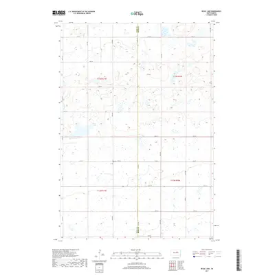
2017 Map of Rezac Lake
USGS Topo · Published 2017About this map
Bohemian Cem and the surrounding prairie of south-central South Dakota define this landscape along the border of Hyde and Hand counties. The area is characterized by a sparse grid of section-line roads, including Bohemian 179th St, which serve the expansive agricultural tracts of the region. The drainage of Baloun Cr and Lost Cr meanders through the rolling terrain, punctuated by small glacial depressions and wetlands common to this part of the Great Plains. Rezac Lake stands as the primary water feature in a township-and-range system that remains remarkably consistent with its original late-19th-century survey layout. This map provides a clear view of the rural infrastructure in the early 21st century, where long-established burial grounds like the Bohemian Cem serve as enduring markers of the settler heritage in these high plains townships.
Find a feature on this map
27 named features on this map. Tap any name to fly to it.
Don’t see what you’re looking for? This feature index may not catch every label — zoom into the map to look around manually.
Map Details
Editions of this 2017 Rezac Lake Map
This is the sole edition of this map. No revisions or reprints were ever made.
Other maps of this area

1949 · Ree Heights NW
USGS Topo · 1:24,000

1949 · Mitchell Lake
USGS Topo · 1:24,000

1950 · Highmore NE
USGS Topo · 1:24,000

1950 · Mitchell Lake
USGS Topo · 1:24,000

1950 · Rezac Lake NE
USGS Topo · 1:24,000

1950 · Rezac Lake
USGS Topo · 1:24,000

1951 · Rezac Lake NE
USGS Topo · 1:24,000

1951 · Rice Lake
USGS Topo · 1:24,000

1951 · Ree Heights NW
USGS Topo · 1:24,000

1951 · Orient SW
USGS Topo · 1:24,000