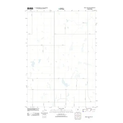
2012 Map of Rezac Lake NW
USGS Topo · Published 2012About this map
Medicine Cr winds through the southern reaches of this Faulk County landscape, serving as a primary drainage for the countless prairie potholes and ephemeral basins that characterize the region. The map reveals a strictly regulated section-line road network typical of the Great Plains, defined by routes such as 165 St and 334th Ave. This grid-like infrastructure facilitates access across the open terrain, where significant land areas are dedicated to water conservation and seasonal wetlands. The presence of Cord 12 highlights the essential connectivity between these remote prairie townships in the early 21st century, illustrating how modern transportation continues to follow the rigid terrestrial boundaries established during the original land surveys.
Find a feature on this map
15 named features on this map. Tap any name to fly to it.
Don’t see what you’re looking for? This feature index may not catch every label — zoom into the map to look around manually.
Map Details
Editions of this 2012 Rezac Lake NW Map
This is the sole edition of this map. No revisions or reprints were ever made.
Other maps of this area

1950 · Rezac Lake NE
USGS Topo · 1:24,000

1950 · Rezac Lake
USGS Topo · 1:24,000

1951 · Rezac Lake NE
USGS Topo · 1:24,000

1951 · Rice Lake
USGS Topo · 1:24,000

1951 · Rezac Lake
USGS Topo · 1:24,000

1951 · Rezac Lake NW
USGS Topo · 1:24,000

1952 · Burkmere
USGS Topo · 1:24,000

1952 · Onaka SW
USGS Topo · 1:24,000

1953 · Huron
USGS Topo · 1:250,000

1954 · Aberdeen
USGS Topo · 1:250,000