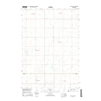
2015 Map of Rezac Lake NW
USGS Topo · Published 2015About this map
Medicine Cr winds through the southwestern corner of this prairie landscape, where the boundary between Faulk Co and Hyde Co is clearly defined along the southern section lines. The terrain is characterized by a high density of small depressions and seasonal water bodies typical of the glaciated plains, interrupted only by the rigid geometry of the Public Land Survey System. A network of rural section-line roads, including 172nd St and 335th Ave, structures the movement across this sparsely populated agricultural region. This survey captures the rural infrastructure as it stood in the mid-2010s, illustrating the persistent importance of township and range lines like t117n r71w in organizing the South Dakota interior.
Find a feature on this map
20 named features on this map. Tap any name to fly to it.
Don’t see what you’re looking for? This feature index may not catch every label — zoom into the map to look around manually.
Map Details
Editions of this 2015 Rezac Lake NW Map
This is the sole edition of this map. No revisions or reprints were ever made.
Other maps of this area

1950 · Rezac Lake NE
USGS Topo · 1:24,000

1950 · Rezac Lake
USGS Topo · 1:24,000

1951 · Rezac Lake NE
USGS Topo · 1:24,000

1951 · Rice Lake
USGS Topo · 1:24,000

1951 · Rezac Lake
USGS Topo · 1:24,000

1951 · Rezac Lake NW
USGS Topo · 1:24,000

1952 · Burkmere
USGS Topo · 1:24,000

1952 · Onaka SW
USGS Topo · 1:24,000

1953 · Huron
USGS Topo · 1:250,000

1954 · Aberdeen
USGS Topo · 1:250,000