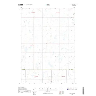
2017 Map of Rezac Lake NW
USGS Topo · Published 2017About this map
Medicine Cr winds through the southern reaches of this landscape, marking the transition between Faulk Co and Hyde Co in central South Dakota. The terrain is defined by a high density of small prairie potholes and wetlands, characteristic of the glaciated plains. This 2017 survey reveals a strictly organized grid of rural section roads, including Co Rd 12 and Co Rd 960, which facilitate movement between the vast agricultural tracts. The map illustrates the persistent structure of the Public Land Survey System, with township and range lines like t117n r71w and t118n r72w providing the foundational geometry for the region's homesteading history and current land use.
Find a feature on this map
21 named features on this map. Tap any name to fly to it.
Don’t see what you’re looking for? This feature index may not catch every label — zoom into the map to look around manually.
Map Details
Editions of this 2017 Rezac Lake NW Map
This is the sole edition of this map. No revisions or reprints were ever made.
Other maps of this area

1950 · Rezac Lake NE
USGS Topo · 1:24,000

1950 · Rezac Lake
USGS Topo · 1:24,000

1951 · Rezac Lake NE
USGS Topo · 1:24,000

1951 · Rice Lake
USGS Topo · 1:24,000

1951 · Rezac Lake
USGS Topo · 1:24,000

1951 · Rezac Lake NW
USGS Topo · 1:24,000

1952 · Burkmere
USGS Topo · 1:24,000

1952 · Onaka SW
USGS Topo · 1:24,000

1953 · Huron
USGS Topo · 1:250,000

1954 · Aberdeen
USGS Topo · 1:250,000