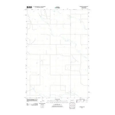
2011 Map of Rhame SE
USGS Topo · Published 2011About this map
North Fork Grand River winds through the southern landscape of this Bowman County region, defining a drainage pattern that characterizes this corner of North Dakota. In this high-plains environment, water features such as Alkali Creek and Cold Turkey Creek provide the primary geographical structure for the area. The map reveals a sparse but methodical human imprint, dominated by a section-line road grid typical of the Great Plains. Essential transit corridors like County Hwy-0823 and Amor Rd serve as the primary connectors between isolated homesteads and grazing lands. This 2011 survey, produced by the U.S. Geological Survey, reflects the persistent rural character of the territory, where the economy remains tied to the land and the seasonal flow of the river and its tributaries.
Find a feature on this map
5 named features on this map. Tap any name to fly to it.
Don’t see what you’re looking for? This feature index may not catch every label — zoom into the map to look around manually.
Map Details
Editions of this 2011 Rhame SE Map
This is the sole edition of this map. No revisions or reprints were ever made.
Other maps of this area

1935 · Reva
USGS Topo · 1:125,000

1935 · Buffalo
USGS Topo · 1:125,000

1953 · Dickinson
USGS Topo · 1:250,000

1954 · Lemmon
USGS Topo · 1:250,000

1957 · Dickinson
USGS Topo · 1:250,000

1957 · Lemmon
USGS Topo · 1:250,000

1968 · Bowman SW
USGS Topo · 1:24,000

1968 · Bowman
USGS Topo · 1:24,000

1968 · Eagles Nest Butte
USGS Topo · 1:24,000

1969 · Ladner NE
USGS Topo · 1:24,000