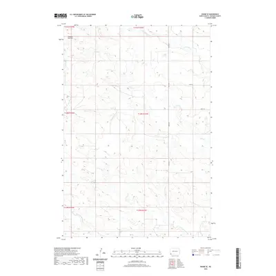
2020 Map of Rhame SE
USGS Topo · Published 2020About this map
Medicine Pole Hills rise in the northwest corner of this Bowman County landscape, anchoring a terrain defined by the headwaters of the N Fork Grand River. This 2020 survey captures a sparsely populated stretch of the North Dakota plains, where the drainage patterns of Cold Turkey Cr and Alkali Cr dictate the layout of the section lines and local transit. The map illustrates a strictly organized rural grid, where the Public Land Survey System township boundaries, such as t131n r103w and t130n r104w, form the primary framework for land division and navigation. Local travel is facilitated by a network of gravel and dirt routes, including Griffin Rd and Amor Rd, which connect the expansive ranchlands and agricultural plots characteristic of the region's contemporary rural economy.
Find a feature on this map
13 named features on this map. Tap any name to fly to it.
Don’t see what you’re looking for? This feature index may not catch every label — zoom into the map to look around manually.
Map Details
Editions of this 2020 Rhame SE Map
This is the sole edition of this map. No revisions or reprints were ever made.
Other maps of this area

1935 · Reva
USGS Topo · 1:125,000

1935 · Buffalo
USGS Topo · 1:125,000

1953 · Dickinson
USGS Topo · 1:250,000

1954 · Lemmon
USGS Topo · 1:250,000

1957 · Dickinson
USGS Topo · 1:250,000

1957 · Lemmon
USGS Topo · 1:250,000

1968 · Bowman SW
USGS Topo · 1:24,000

1968 · Bowman
USGS Topo · 1:24,000

1968 · Eagles Nest Butte
USGS Topo · 1:24,000

1969 · Ladner NE
USGS Topo · 1:24,000