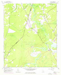
1943 Map of Rhems
USGS Topo · Published 1976About this map
The winding Black River and its dense network of tributaries, such as Black Mingo Creek, define the landscape along the boundary of Georgetown and Williamsburg Counties. This mid-century view shows a rural society centered around small settlements and estates, including Rhems Plantation and Wee Neel Plantation. The importance of water and overland transport is evident in features like Browns Ferry, providing a look at a time before modern infrastructure fully bridged these lowcountry wetlands.
Find a feature on this map
42 named features on this map. Tap any name to fly to it.
Don’t see what you’re looking for? This feature index may not catch every label — zoom into the map to look around manually.
Map Details
Editions of this 1943 Rhems Map
2 editions found
Other maps of this area

1943 · Olin
USGS Topo · 1:31,680

1943 · Henry
USGS Topo · 1:24,000

1943 · Carvers Bay
USGS Topo · 1:24,000

1943 · Rhems
USGS Topo · 1:24,000

1943 · Andrews
USGS Topo · 1:24,000

1943 · Georgetown North
USGS Topo · 1:24,000

1943 · Outland
USGS Topo · 1:24,000

1944 · Outland
USGS Topo · 1:31,680

1946 · Indiantown
USGS Topo · 1:62,500

1949 · Georgetown
USGS Topo · 1:250,000