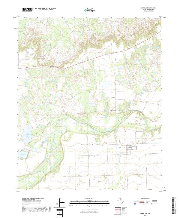
2022 Map of Rhineland
USGS Topo · Published 2022About this map
Rhineland stands as a primary community in this section of Knox County, characterized by its grid of local roads and the presence of Saint Josephs Cem. The landscape is dominated by the winding course of the Brazos River, which creates a complex hydrology of wetlands and seasonal water features. To the north, the terrain rises toward a distinctive formation known as The Narrows, where the land begins to break into more dissected drainage patterns.
Find a feature on this map
44 named features on this map. Tap any name to fly to it.
Don’t see what you’re looking for? This feature index may not catch every label — zoom into the map to look around manually.
Map Details
Editions of this 2022 Rhineland Map
This is the sole edition of this map. No revisions or reprints were ever made.
Other maps of this area

1954 · Wichita Falls
USGS Topo · 1:250,000

1958 · Wichita Falls
USGS Topo · 1:250,000

1966 · Truscott South
USGS Topo · 1:24,000

1966 · Gilliland
USGS Topo · 1:24,000

1966 · Vera
USGS Topo · 1:24,000

1967 · Hefner
USGS Topo · 1:24,000

1967 · Benjamin
USGS Topo · 1:24,000

1967 · Rhineland
USGS Topo · 1:24,000

1968 · Munday West
USGS Topo · 1:24,000
1968 · Munday East
USGS Topo · 1:24,000