
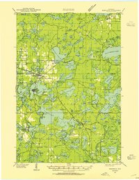
1940 Map of Rhinelander
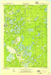
USGS Topo · Published 1961About this map
Rhinelander serves as the industrial and transit hub of this lake-strewn landscape, where the Chicago and Northwestern and the Milwaukee St Paul and Pacific railroads converge along the banks of Boom Lake. The 1940 field examination reveals a region deeply defined by its water and timber heritage, with numerous small schools scattered through the woods to serve rural families, including Wildwood Sch, Hammel Sch, and Roosevelt Sch. A Slaughterhouse near the city's edge and the concentration of rail lines suggest the local importance of processing and transport for the surrounding agricultural and forest lands.
Find a feature on this map
95 named features on this map. Tap any name to fly to it.
Don’t see what you’re looking for? This feature index may not catch every label — zoom into the map to look around manually.
Map Details
Editions of this 1940 Rhinelander Map
This is the sole edition of this map. No revisions or reprints were ever made.
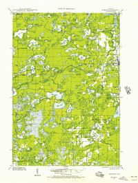
Other maps of this area

1928 · Three Lakes
USGS Topo · 1:48,000

1930 · Robbins
USGS Topo · 1:48,000
1938 · Minocqua
USGS Topo · 1:48,000
1938 · Three Lakes
USGS Topo · 1:48,000
1938 · Robbins
USGS Topo · 1:48,000

1939 · Cassian
USGS Topo · 1:48,000

1940 · Parrish
USGS Topo · 1:48,000

1940 · Monico
USGS Topo · 1:48,000

1942 · Cassian
USGS Topo · 1:48,000

1942 · Elcho
USGS Topo · 1:48,000