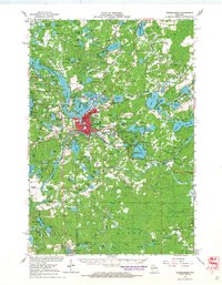
1966 Map of Rhinelander
USGS Topo · Published 1968About this map
Rhinelander serves as the industrial and transportation hub of this lake-strewn landscape in the mid-1960s. The city is a nexus for the Soo Line and Chicago and Northwestern railroads, which facilitated the movement of goods through northern Wisconsin. Beyond the urban center, the map reveals a community organized around its natural resources and civic institutions, featuring numerous rural schools like Pine Lake Sch and Curran Sch. The presence of Camp Tesomas and the Country Club north of town points to the area's established role as a recreational destination. Smaller outlying settlements such as Roosevelt and Malvern are documented alongside local landmarks like Northland Memorial Park and Our Saviour Ch. The dense concentration of water bodies, from Moen Lake to the Frederick Flowage, illustrates the complex hydrologic character of the Oneida and Lincoln County borderlands during this era.
Find a feature on this map
145 named features on this map. Tap any name to fly to it.
Don’t see what you’re looking for? This feature index may not catch every label — zoom into the map to look around manually.
Map Details
Editions of this 1966 Rhinelander Map
This is the sole edition of this map. No revisions or reprints were ever made.
Other maps of this area

1928 · Three Lakes
USGS Topo · 1:48,000

1930 · Robbins
USGS Topo · 1:48,000

1938 · Minocqua
USGS Topo · 1:48,000

1938 · Three Lakes
USGS Topo · 1:48,000

1938 · Robbins
USGS Topo · 1:48,000

1939 · Cassian
USGS Topo · 1:48,000

1940 · Parrish
USGS Topo · 1:48,000

1940 · Monico
USGS Topo · 1:48,000

1940 · Rhinelander
USGS Topo · 1:48,000

1942 · Cassian
USGS Topo · 1:48,000