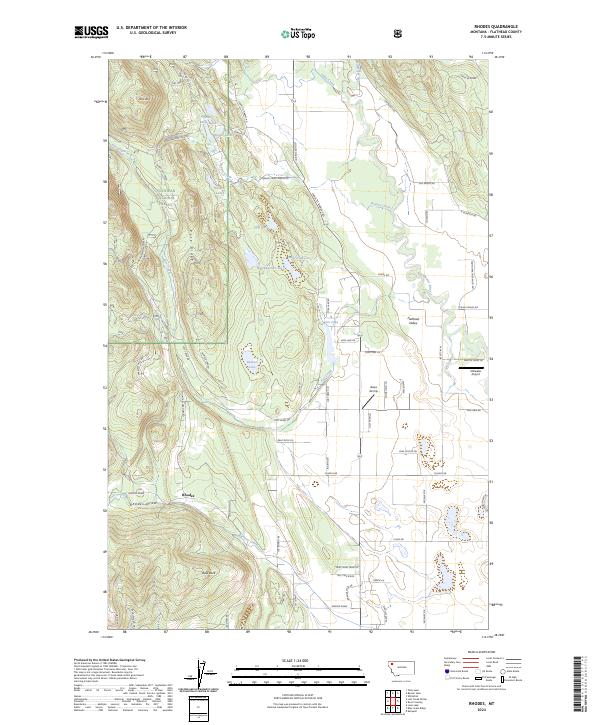
2024 Map of Rhodes
USGS Topo · Published 2024About this map
Rhodes lies at the western edge of the Flathead Valley, where the drainage of Big Lost Creek and Lost Creek meets the agricultural flats. This modern survey illustrates the transition from the timbered heights of the Flathead National Forest to the valley floor, characterized by a network of ranch roads like K M Ranch Rd and Spring Prairie Rd. Local aviation is well-represented by the Stillwater Airport and Bates Airstrip, reflecting the utility of light aircraft in this expansive landscape. Notable water bodies, including Bowser Lake and Hanson-Doyle Lake, sit along the complex ridgelines of Pete Ridge and Spencer Ridge. The presence of named features like Rhodes Draw and Bald Rock provides specific landmarks for those tracing family property lines or local history in this part of Flathead County.
Find a feature on this map
73 named features on this map. Tap any name to fly to it.
Don’t see what you’re looking for? This feature index may not catch every label — zoom into the map to look around manually.
Map Details
Editions of this 2024 Rhodes Map
This is the sole edition of this map. No revisions or reprints were ever made.
Other maps of this area

1943 · Kalispell
USGS Topo · 1:125,000

1957 · Kalispell
USGS Topo · 1:250,000

1960 · Kalispell
USGS Topo · 1:250,000

1961 · Kalispell
USGS Topo · 1:250,000

1962 · Rose Crossing
USGS Topo · 1:24,000

1962 · Blue Grass Ridge
USGS Topo · 1:24,000

1962 · Beaver Lake
USGS Topo · 1:24,000

1962 · Lost Creek Divide
USGS Topo · 1:24,000

1962 · Rhodes
USGS Topo · 1:24,000
1962 · Kalispell
USGS Topo · 1:24,000