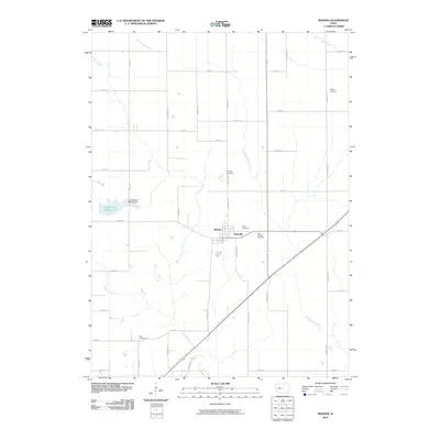
2010 Map of Rhodes
USGS Topo · Published 2010About this map
Rhodes and the adjacent settlement of Edenville anchor this portion of Marshall County, situated along the upper reaches of the North Skunk River. The landscape is defined by the gentle drainage patterns of Clear Creek and Willow Creek, which wind through a structured grid of county roads. For local historians and genealogists, the map is remarkably dense with burial sites, including the centrally located Eden Cemetery and Saint Josephs Cemetery, as well as the outlying Wilkey Cemetery, Day Cemetery, and Nicholls Cemetery. The northwest corner of the quadrangle is dominated by the Hendrickson Marsh Lake, regulated by the Hendrickson Marsh Dam, serving as a significant local landmark and conservation area. The spatial arrangement of these features illustrates a classic Midwestern agricultural township, where small communities and family-named cemeteries are connected by an extensive network of gravel and paved avenues.
Find a feature on this map
43 named features on this map. Tap any name to fly to it.
Don’t see what you’re looking for? This feature index may not catch every label — zoom into the map to look around manually.
Map Details
Editions of this 2010 Rhodes Map
This is the sole edition of this map. No revisions or reprints were ever made.
Other maps of this area

1954 · Waterloo
USGS Topo · 1:250,000

1954 · Des Moines
USGS Topo · 1:250,000

1955 · Waterloo
USGS Topo · 1:250,000

1956 · Des Moines
USGS Topo · 1:250,000

1957 · Des Moines
USGS Topo · 1:250,000

1969 · Des Moines
USGS Topo · 1:250,000

1975 · Mingo
USGS Topo · 1:24,000

1975 · State Center
USGS Topo · 1:24,000

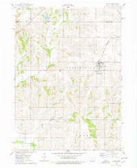
1975 · Rhodes
USGS Topo · 1:24,000
1975 · Baxter
USGS Topo · 1:24,000