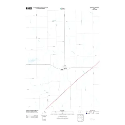
2013 Map of Rhodes
USGS Topo · Published 2013About this map
Rhodes and Edenville occupy the center of this Marshall County survey, where the grid of rural township roads meets the winding courses of several significant waterways. The landscape is defined by the N Skunk River flowing toward the southeast, joined by tributaries including Clear Cr and Willow Cr. In the western portion of the quadrangle, Hendrickson Marsh Lake provides a distinct break from the surrounding agricultural layout. This map captures the modern road network of Eden Township, anchored by local arteries such as N Main St and W Walnut St within the town center. The geometry of the landscape reflects a long history of prairie settlement, with named corridors like Binford Ave and Brown Ave sectioning the land around the river valleys and creek beds.
Find a feature on this map
42 named features on this map. Tap any name to fly to it.
Don’t see what you’re looking for? This feature index may not catch every label — zoom into the map to look around manually.
Map Details
Editions of this 2013 Rhodes Map
This is the sole edition of this map. No revisions or reprints were ever made.
Other maps of this area

1954 · Waterloo
USGS Topo · 1:250,000

1954 · Des Moines
USGS Topo · 1:250,000

1955 · Waterloo
USGS Topo · 1:250,000

1956 · Des Moines
USGS Topo · 1:250,000

1957 · Des Moines
USGS Topo · 1:250,000

1969 · Des Moines
USGS Topo · 1:250,000

1975 · Mingo
USGS Topo · 1:24,000

1975 · State Center
USGS Topo · 1:24,000

1975 · Rhodes
USGS Topo · 1:24,000
1975 · Baxter
USGS Topo · 1:24,000