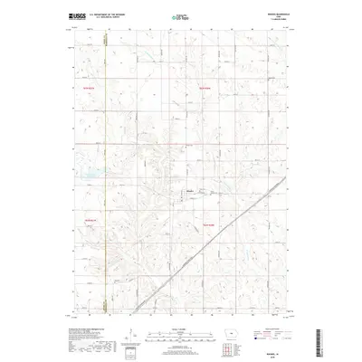
2018 Map of Rhodes
USGS Topo · Published 2018About this map
Rhodes sits at the heart of this central Iowa landscape, positioned at the intersection of E Jefferson St and E Walnut St. The town is flanked by a significant concentration of local burial grounds, including Eden Cem to the east and Saint Josephs Cem just beyond, providing a clear spatial record for genealogical research. The terrain is defined by the winding course of the N Skunk River and its tributaries, such as Clear Cr and N-Timber Cr, which cut through the agricultural grid. To the west, the extensive waters of Hendrickson Marsh Lake dominate the lowlands near the Story and Marshall County line. This 2018 survey illustrates the persistent rural infrastructure of the region, where a dense network of numbered gravel roads and routes like Marshalltown Blvd connect isolated farmsteads and historical sites like Day Cem and Wilkey Cem.
Find a feature on this map
39 named features on this map. Tap any name to fly to it.
Don’t see what you’re looking for? This feature index may not catch every label — zoom into the map to look around manually.
Map Details
Editions of this 2018 Rhodes Map
This is the sole edition of this map. No revisions or reprints were ever made.
Other maps of this area

1954 · Waterloo
USGS Topo · 1:250,000

1954 · Des Moines
USGS Topo · 1:250,000

1955 · Waterloo
USGS Topo · 1:250,000

1956 · Des Moines
USGS Topo · 1:250,000

1957 · Des Moines
USGS Topo · 1:250,000

1969 · Des Moines
USGS Topo · 1:250,000

1975 · Mingo
USGS Topo · 1:24,000

1975 · State Center
USGS Topo · 1:24,000

1975 · Rhodes
USGS Topo · 1:24,000
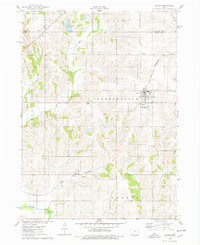
1975 · Baxter
USGS Topo · 1:24,000