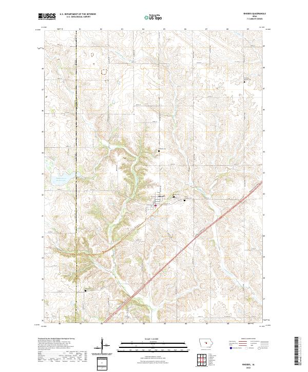
2022 Map of Rhodes
USGS Topo · Published 2022About this map
The town of Rhodes sits at the heart of this Central Iowa landscape, situated along the county line separating Story Co and Marshall Co. The terrain is defined by the winding course of the N Skunk River and its various tributaries, including Clear Cr and Willow Cr. This modern survey illustrates the repurposing of former railroad corridors into recreational routes, notably the Heart of Iowa Nature Trl which cuts across the township. For genealogists and local historians, the map is particularly useful for locating several rural burial grounds scattered across the countryside, such as German Baptist Cem to the northeast and Saint Josephs Cem and Eden Cem near the town center. The western edge is dominated by the Hendrickson Marsh Lake, a significant wetland feature that shapes the local drainage patterns near Plum Cr.
Find a feature on this map
15 named features on this map. Tap any name to fly to it.
Don’t see what you’re looking for? This feature index may not catch every label — zoom into the map to look around manually.
Map Details
Editions of this 2022 Rhodes Map
This is the sole edition of this map. No revisions or reprints were ever made.
Other maps of this area

1954 · Waterloo
USGS Topo · 1:250,000

1954 · Des Moines
USGS Topo · 1:250,000

1955 · Waterloo
USGS Topo · 1:250,000

1956 · Des Moines
USGS Topo · 1:250,000

1957 · Des Moines
USGS Topo · 1:250,000

1969 · Des Moines
USGS Topo · 1:250,000

1975 · Mingo
USGS Topo · 1:24,000

1975 · State Center
USGS Topo · 1:24,000

1975 · Rhodes
USGS Topo · 1:24,000
1975 · Baxter
USGS Topo · 1:24,000