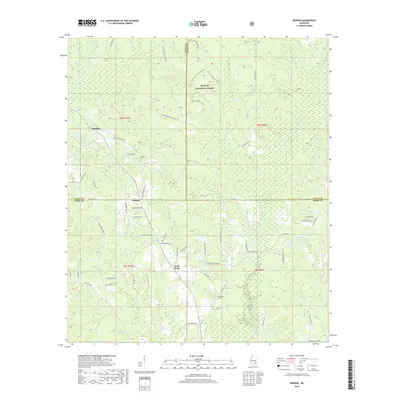
2018 Map of Rhodes
USGS Topo · Published 2018About this map
De Soto National Forest dominates the landscape of this southern Mississippi region, where the borders of Jones, Wayne, and Perry Counties converge. The terrain is defined by a dense network of minor waterways including Tiger Creek, Beaver Dam Cr, and Little Thompson Cr, which carve through the timberlands. Small rural settlements like Blodgett, Rhodes, and Good Hope serve as local anchors, connected by a web of family-named roads such as Emma Thompson Rd and Earl Finley Rd. This 2018 survey illustrates a modern landscape where traditional forest management and rural residency meet recreational use, evidenced by the Little Tiger ATV Trail system. Genealogists will find value in the location of the Edwards Cem and Brown Cem, which remain as quiet landmarks of the area's long-standing families.
Find a feature on this map
64 named features on this map. Tap any name to fly to it.
Don’t see what you’re looking for? This feature index may not catch every label — zoom into the map to look around manually.
Map Details
Editions of this 2018 Rhodes Map
This is the sole edition of this map. No revisions or reprints were ever made.
Other maps of this area

1953 · Hattiesburg
USGS Topo · 1:250,000

1958 · Hattiesburg
USGS Topo · 1:250,000

1963 · Brewer
USGS Topo · 1:24,000

1964 · Rhodes
USGS Topo · 1:24,000

1964 · Ovett SE
USGS Topo · 1:24,000

1964 · Ovett
USGS Topo · 1:24,000

1964 · Richton
USGS Topo · 1:24,000

1964 · Strengthford
USGS Topo · 1:24,000

1964 · Mulberry
USGS Topo · 1:24,000

1964 · Lanham
USGS Topo · 1:24,000