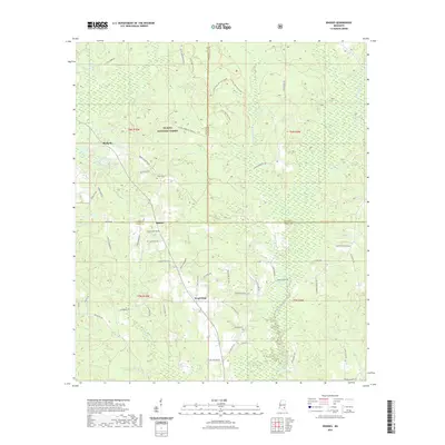
2021 Map of Rhodes
USGS Topo · Published 2021About this map
De Soto National Forest dominates the northern landscape of this region, where the piney woods are marked by a network of drainage systems including Thompson Creek and Tiger Cr. The settlement patterns here are defined by small communities such as Good Hope, Rhodes, and Blodgett, which serve as hubs for a rural road network heavily influenced by forestry and family landholdings. This modern survey illustrates the persistent importance of local history through sites like Brown Cem and Edwards Cem, while also documenting contemporary recreational use via the Little Tiger Atv Trail. The confluence of Jones, Perry, and Wayne counties creates a jurisdictional puzzle, as multiple creek branches like Beaver Dam Cr and Sweetwater Cr carve through the terrain, illustrating the enduring relationship between the area's hydrology and its secondary road development.
Find a feature on this map
62 named features on this map. Tap any name to fly to it.
Don’t see what you’re looking for? This feature index may not catch every label — zoom into the map to look around manually.
Map Details
Editions of this 2021 Rhodes Map
This is the sole edition of this map. No revisions or reprints were ever made.
Other maps of this area

1953 · Hattiesburg
USGS Topo · 1:250,000

1958 · Hattiesburg
USGS Topo · 1:250,000

1963 · Brewer
USGS Topo · 1:24,000

1964 · Rhodes
USGS Topo · 1:24,000

1964 · Ovett SE
USGS Topo · 1:24,000

1964 · Ovett
USGS Topo · 1:24,000

1964 · Richton
USGS Topo · 1:24,000

1964 · Strengthford
USGS Topo · 1:24,000

1964 · Mulberry
USGS Topo · 1:24,000

1964 · Lanham
USGS Topo · 1:24,000