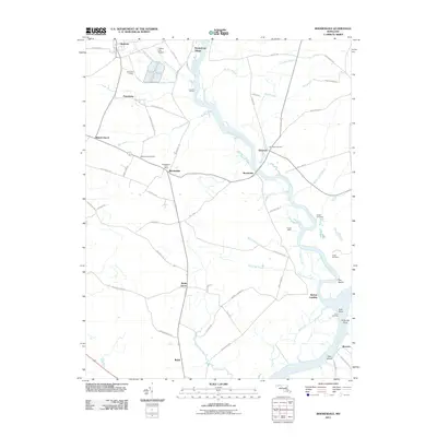
2011 Map of Rhodesdale
USGS Topo · Published 2011About this map
Marshyhope Creek defines the local geography as it flows south toward its confluence with the Nanticoke River, anchoring a series of riverine landings and points. This 2011 survey records the rural layout of Dorchester County, where small agricultural hamlets like Rhodesdale and Eldorado are connected by a network of family-named roads such as Ennels Rd and Palmer Mill Rd. The transition from water-based transit to rail and road is visible in features like Ennalls Wharf and Walnut Landing alongside the rail-adjacent Websters Siding.
Find a feature on this map
72 named features on this map. Tap any name to fly to it.
Don’t see what you’re looking for? This feature index may not catch every label — zoom into the map to look around manually.
Map Details
Editions of this 2011 Rhodesdale Map
This is the sole edition of this map. No revisions or reprints were ever made.
Other maps of this area

1901 · Salisbury
USGS Topo · 1:62,500

1903 · Nanticoke
USGS Topo · 1:62,500

1905 · Hurlock
USGS Topo · 1:62,500

1915 · Seaford
USGS Topo · 1:62,500

1942 · Mardela Springs
USGS Topo · 1:24,000

1942 · Hebron
USGS Topo · 1:24,000
1942 · Chicamacomico
USGS Topo · 1:24,000
1943 · Chicamacomico
USGS Topo · 1:31,680
1943 · Mardela Springs
USGS Topo · 1:31,680

1943 · Hebron
USGS Topo · 1:31,680