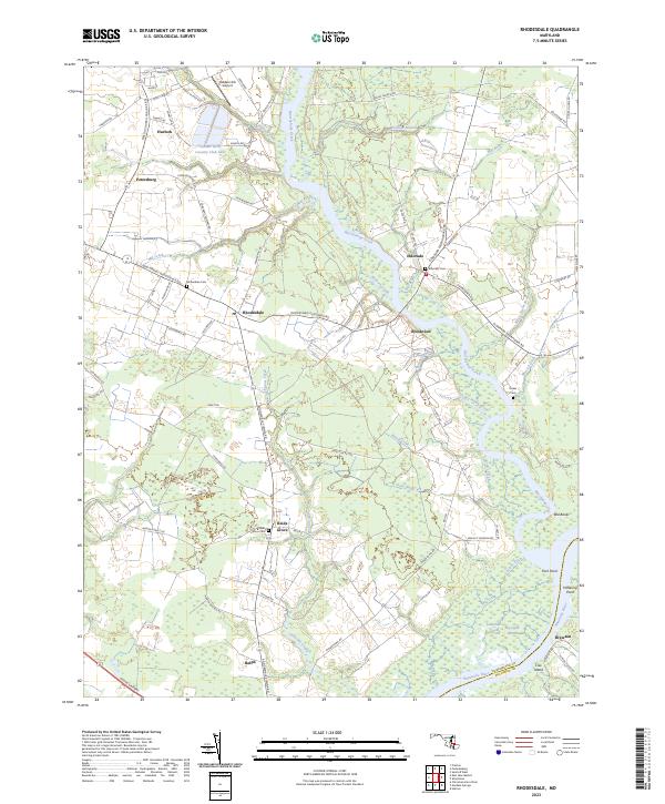
2023 Map of Rhodesdale
USGS Topo · Published 2023About this map
Marshyhope Creek winds through the center of this Dorchester County landscape, joining the Nanticoke River at the southern boundary. This Eastern Shore terrain is defined by its low-lying hydrology, where complex drainage systems like Laytons Ditch and Messick Ditch serve the agricultural fields surrounding settlements such as Rhodesdale and Eldorado. The map reveals a dense network of family and local history markers, including the Corkran Cem, McKendree Cem, and Reids Grove Cem, which anchor the small rural communities of Petersburg and Reids Grove.
Find a feature on this map
82 named features on this map. Tap any name to fly to it.
Don’t see what you’re looking for? This feature index may not catch every label — zoom into the map to look around manually.
Map Details
Editions of this 2023 Rhodesdale Map
This is the sole edition of this map. No revisions or reprints were ever made.
Other maps of this area

1901 · Salisbury
USGS Topo · 1:62,500

1903 · Nanticoke
USGS Topo · 1:62,500

1905 · Hurlock
USGS Topo · 1:62,500

1915 · Seaford
USGS Topo · 1:62,500

1942 · Mardela Springs
USGS Topo · 1:24,000

1942 · Hebron
USGS Topo · 1:24,000
1942 · Chicamacomico
USGS Topo · 1:24,000
1943 · Chicamacomico
USGS Topo · 1:31,680
1943 · Mardela Springs
USGS Topo · 1:31,680

1943 · Hebron
USGS Topo · 1:31,680