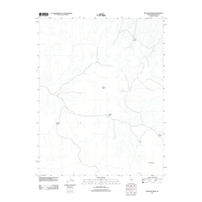
2011 Map of Rhyolite Ridge
USGS Topo · Published 2011About this map
Rhyolite Ridge and the high desert terrain of Esmeralda County are defined by a scattered network of essential water sources and former industrial sites. The presence of the Crown Mill near Valcalda Spring points to the mineral extraction history of the region, while the numerous named springs, such as Minnesota Spring, Mamie Spring, and Red Mountain Spring, indicate the critical importance of reliable water in this arid landscape. Steep topographical features like Argentite Canyon and Black Canyon carve through the land, with Coyote Summit providing a natural pass. The mapping of Coyote Hole and Cave Spring further illustrates the local reliance on specific geological features for survival and navigation in the Nevada wilderness during the early 21st century.
Find a feature on this map
13 named features on this map. Tap any name to fly to it.
Don’t see what you’re looking for? This feature index may not catch every label — zoom into the map to look around manually.
Map Details
Editions of this 2011 Rhyolite Ridge Map
This is the sole edition of this map. No revisions or reprints were ever made.
Other maps of this area

1898 · Silver Peak
USGS Topo · 1:125,000

1900 · Silver Peak
USGS Topo · 1:125,000

1908 · Lida
USGS Topo · 1:250,000

1913 · Lida
USGS Topo · 1:250,000

1954 · Goldfield
USGS Topo · 1:250,000

1955 · Goldfield
USGS Topo · 1:250,000

1958 · Goldfield
USGS Topo · 1:250,000

1962 · Goldfield
USGS Topo · 1:250,000
1963 · Piper Peak
USGS Topo · 1:62,500

1963 · Silver Peak
USGS Topo · 1:62,500