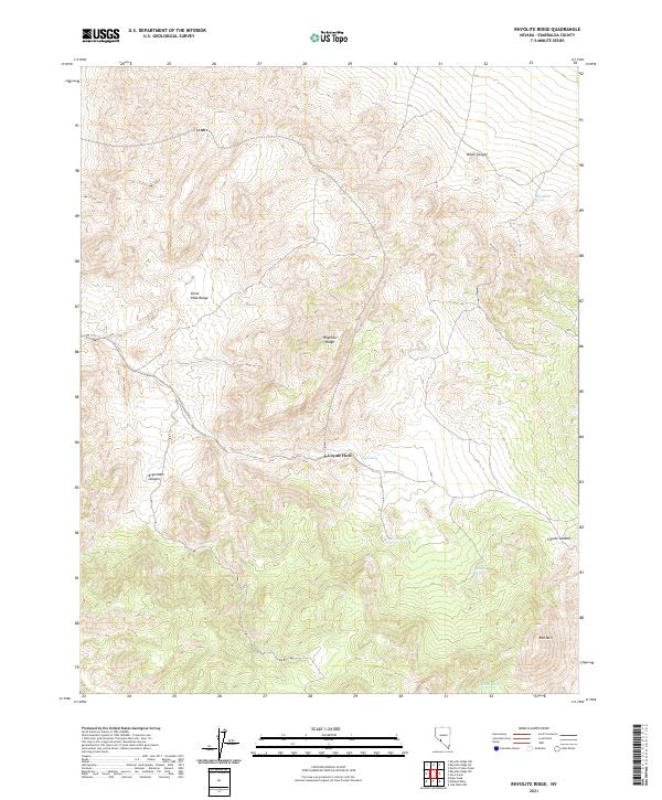
2021 Map of Rhyolite Ridge
USGS Topo · Published 2021About this map
The Silver Peak Range dominates this portion of Esmeralda County, defining a landscape marked by steep elevation changes and isolated water sources. As a modern survey of a high-desert environment, the map emphasizes the vital role of springs in an arid climate, documenting locations such as Minnesota Spring, Mamie Spring, and Valcalda Spring scattered across the ridgelines. The namesake Rhyolite Ridge serves as a central spine for the quadrangle, flanked by deep incisions like Argentite Canyon and Black Canyon. The absence of developed townsites or major infrastructure highlights the region's enduring character as a mining and ranching frontier, where travel is dictated by natural passes like Coyote Summit and the presence of ephemeral or permanent water at sites like Coyote Hole.
Find a feature on this map
18 named features on this map. Tap any name to fly to it.
Don’t see what you’re looking for? This feature index may not catch every label — zoom into the map to look around manually.
Map Details
Editions of this 2021 Rhyolite Ridge Map
This is the sole edition of this map. No revisions or reprints were ever made.
Other maps of this area

1898 · Silver Peak
USGS Topo · 1:125,000

1900 · Silver Peak
USGS Topo · 1:125,000

1908 · Lida
USGS Topo · 1:250,000

1913 · Lida
USGS Topo · 1:250,000

1954 · Goldfield
USGS Topo · 1:250,000

1955 · Goldfield
USGS Topo · 1:250,000

1958 · Goldfield
USGS Topo · 1:250,000

1962 · Goldfield
USGS Topo · 1:250,000
1963 · Piper Peak
USGS Topo · 1:62,500

1963 · Silver Peak
USGS Topo · 1:62,500