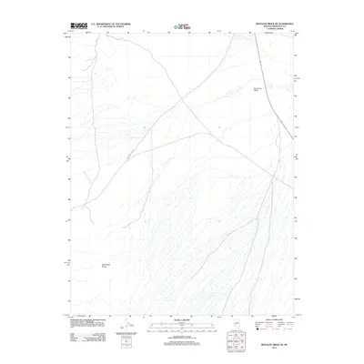
2012 Map of Rhyolite Ridge NE
USGS Topo · Published 2012About this map
Silver Peak Range slopes down into the broad expanse of the Big Smoky Valley in this remote stretch of Esmeralda County. The landscape is defined by a dense network of intermittent drainage channels that fan out from the high ground, illustrating the arid hydrology of the Great Basin. Transportation through this high-desert terrain is limited to a few primary corridors, most notably Emigrant Pass Rd, which cuts diagonally across the valley floor, and State Route 265 running along the eastern edge. The map provides a detailed view of the alluvial fans and complex topography that characterize the transition between the mountain peaks and the valley floor, offering a precise look at the landforms as they were surveyed in the early twenty-first century.
Find a feature on this map
4 named features on this map. Tap any name to fly to it.
Don’t see what you’re looking for? This feature index may not catch every label — zoom into the map to look around manually.
Map Details
Editions of this 2012 Rhyolite Ridge NE Map
This is the sole edition of this map. No revisions or reprints were ever made.
Other maps of this area

1898 · Silver Peak
USGS Topo · 1:125,000

1900 · Silver Peak
USGS Topo · 1:125,000

1907 · Tonopah
USGS Topo · 1:250,000

1908 · Lida
USGS Topo · 1:250,000

1908 · Tonopah
USGS Topo · 1:250,000

1913 · Lida
USGS Topo · 1:250,000

1954 · Goldfield
USGS Topo · 1:250,000

1955 · Goldfield
USGS Topo · 1:250,000

1956 · Tonopah
USGS Topo · 1:250,000

1958 · Goldfield
USGS Topo · 1:250,000