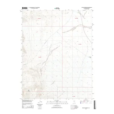
2015 Map of Rhyolite Ridge NE
USGS Topo · Published 2015About this map
The Silver Peak Range dominates this portion of Esmeralda County, Nevada, where the steep slopes of the high desert give way to the floor of the Big Smoky Valley. This 2015 survey captures a stark landscape defined by elevation change, with the terrain falling away from the ridgelines in the west toward the broad basin in the east. The only major transit corridor shown is Emigrant Pass Rd, which winds through the mountain passes, following a route historically critical for movement through this arid part of the Great Basin. This map is particularly useful for understanding the physical geography and modern township boundaries of the Silver Peak area, including the intersections of sections within T1N R37E and T1N R38E, which serve as foundational markers for regional land claims and mining history.
Find a feature on this map
9 named features on this map. Tap any name to fly to it.
Don’t see what you’re looking for? This feature index may not catch every label — zoom into the map to look around manually.
Map Details
Editions of this 2015 Rhyolite Ridge NE Map
This is the sole edition of this map. No revisions or reprints were ever made.
Other maps of this area

1898 · Silver Peak
USGS Topo · 1:125,000

1900 · Silver Peak
USGS Topo · 1:125,000

1907 · Tonopah
USGS Topo · 1:250,000

1908 · Lida
USGS Topo · 1:250,000

1908 · Tonopah
USGS Topo · 1:250,000

1913 · Lida
USGS Topo · 1:250,000

1954 · Goldfield
USGS Topo · 1:250,000

1955 · Goldfield
USGS Topo · 1:250,000

1956 · Tonopah
USGS Topo · 1:250,000

1958 · Goldfield
USGS Topo · 1:250,000