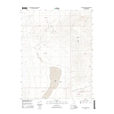
2014 Map of Rhyolite Ridge NW
USGS Topo · Published 2014About this map
The Silver Peak Range dominates the eastern portion of this high-desert landscape in Esmeralda County. Rising to the prominent Emigrant Peak, the terrain transitions sharply into the basin of Fish Lake Valley to the west. This basin is characterized by the Fish Lake Valley Marsh, a distinct hydrological feature in an otherwise arid environment. Historical movement through these mountains is etched into the land by Emigrant Pass Rd, which winds through the namesake Emigrant Pass. At the northwestern edge, Gap Spring indicates a critical water source in the remote high-elevation drainage. The map provides a precise layout of township and range lines, including t2n r36e and t1n r37e, which anchor the cadastral history of this corner of the Great Basin.
Find a feature on this map
13 named features on this map. Tap any name to fly to it.
Don’t see what you’re looking for? This feature index may not catch every label — zoom into the map to look around manually.
Map Details
Editions of this 2014 Rhyolite Ridge NW Map
This is the sole edition of this map. No revisions or reprints were ever made.
Other maps of this area

1898 · Silver Peak
USGS Topo · 1:125,000

1900 · Silver Peak
USGS Topo · 1:125,000

1907 · Tonopah
USGS Topo · 1:250,000

1908 · Lida
USGS Topo · 1:250,000

1908 · Tonopah
USGS Topo · 1:250,000

1909 · Hawthorne
USGS Topo · 1:250,000

1911 · Hawthorne
USGS Topo · 1:250,000

1913 · Lida
USGS Topo · 1:250,000

1915 · Hawthorne
USGS Topo · 1:250,000

1917 · White Mountain
USGS Topo · 1:125,000